Maps of the Jovian Moons.
Maps of the Galilean moons
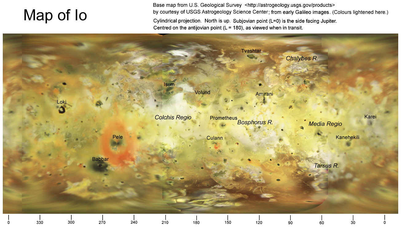
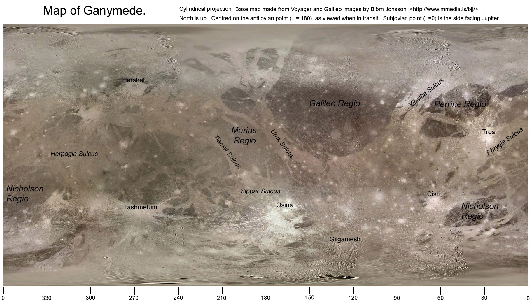
Here is a set of maps of the Galilean moons, from Voyager and Galileo images,
with the major features labelled. These will be useful for observers whose
images manage to resolve surface features on the moons. They are centred
on the side that faces away from Jupiter, and extend from the north pole (top)
to south pole (bottom) with equal spacing per degree of latitude. The base
maps have been chosen to have moderate resolution and uniform colour rendition,
and IAU-approved names have been added for the most conspicuous features (except
for Europa whose features are all comparatively small).
The base maps are either from the U.S. Geological Survey:
http://astrogeology.usgs.gov/products
(which also provides hi-res maps)
or from Björn Jonsson:
http://www.mmedia.is/bjj/
--See their web sites if you wish to reproduce the maps.
For simulated views of the moons as seen from Earth at any given time, you can
use the (Ephemerides / Graphics) option in WinJUPOS, available from:


_________________________________
John H. Rogers, Ph.D. Jupiter Section Director,
British Astronomical Association
jhr11@cam.ac.uk
http://www.britastro.org/jupiter/