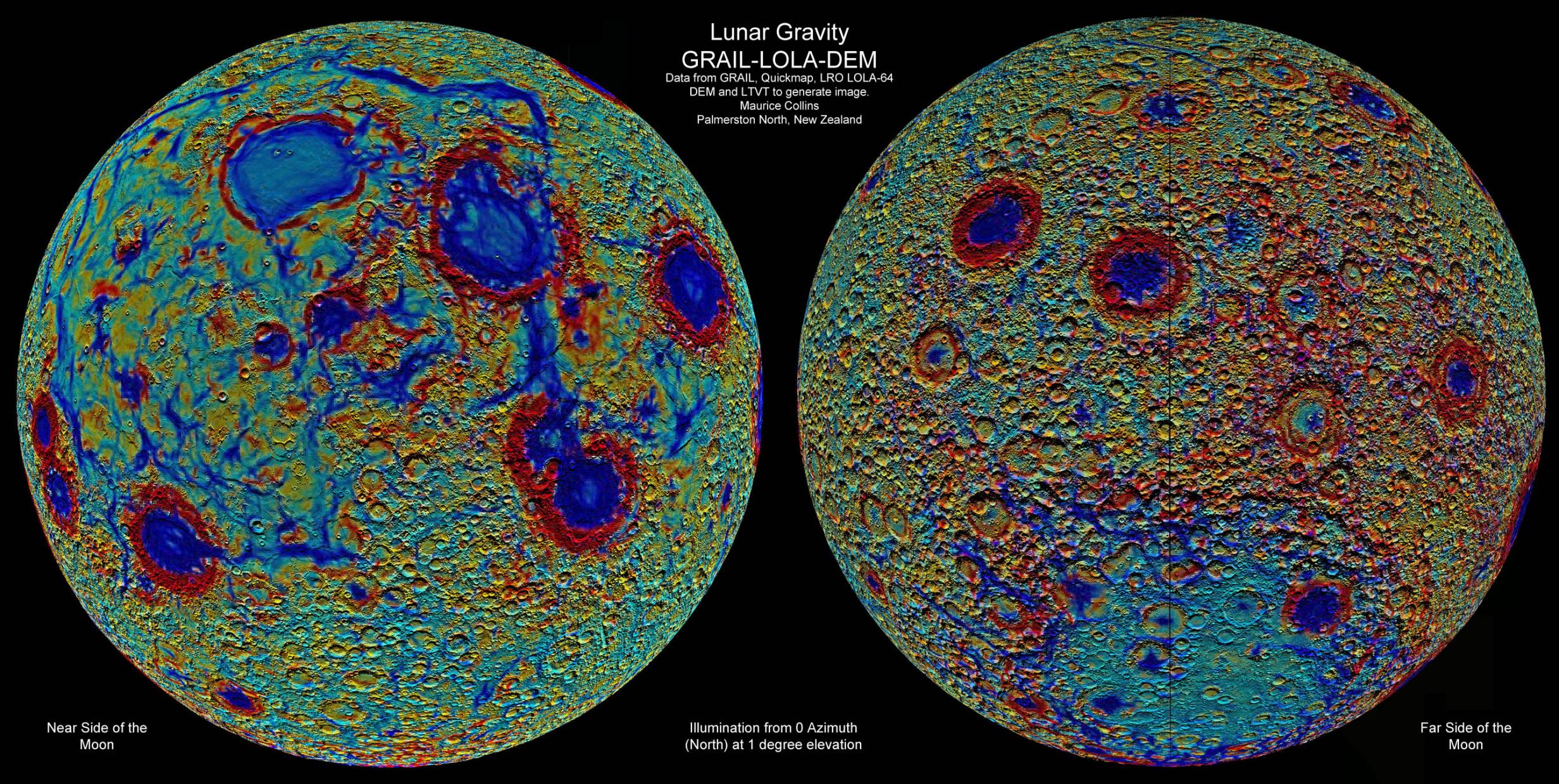
Observation by Maurice J. S. Collins: Lunar GRAIL-Topomap with LTVT

Uploaded by

Maurice Collins

Observer

Maurice J. S. Collins

Observed

2017 Sep 10 - 04:56

Uploaded

2017 Sep 10 - 05:01

Objects

The Moon

Target name

Lunar Gravity Map

Title

Lunar GRAIL-Topomap with LTVT

About this image

I used the GRAIL overlay map from LRO Quickmap, imported it into LTVT - Lunar Terminator Visualization Tool. Then used LTVT to combine it with the LOLA-64 Digital Elevation Model (DEM). I set the sun from the North (yes I know that is unusual, but it brings out different features), at 1 degree elevation above the horizon. I set LTVT to not cast shadows so as to see inside craters easier. I then set LTVT to zoom 5.0 and gamma 1.6 and spread it over both my monitors and generated the DEM's. I saved them and stitched them together with Microsoft ICE and added labels in Photoshop. I did this for the near side and far side of the Moon to make the resulting map.

Files associated with this observation
Like this image
Comments
Neil Morrison
Neil Morrison, 2017 Sep 10 - 16:49 UTC

The maps show the Moon in a very new light  and  give a new way of  bringing out  the  details in  Impact  Basins  and High lands.  Set along side  conventional Images of the  Lunars faces  it  shows that  the Moon is an area for  more detailed  scrutiny.

Great  Image .

Copyright of all images and other observations submitted to the BAA remains with the owner of the work. Reproduction of work by third parties is expressly forbidden without the consent of the copyright holder. By submitting images to this online gallery, you grant the BAA permission to reproduce them in any of our publications.