Juno at PJ56
JunoCam at PJ56: preliminary report
John Rogers (2023 Dec.27)
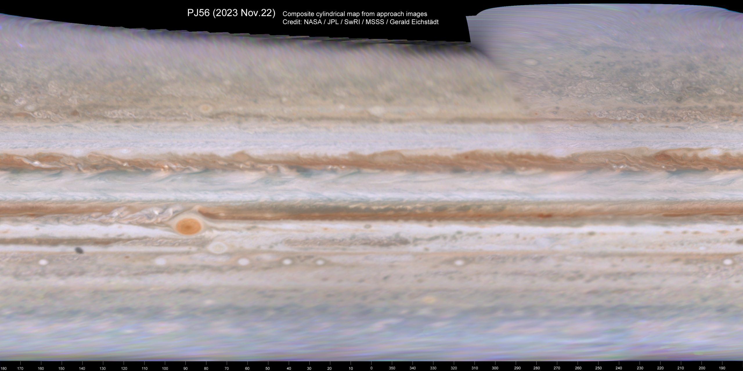
Juno’s PJ56 was on 2023 Nov.22, with equator crossing (on the dark side) at L3=136. Most of the inbound images were normal, so Gerald Eichstädt was able to make composite cylindrical maps as usual (Figure 1).
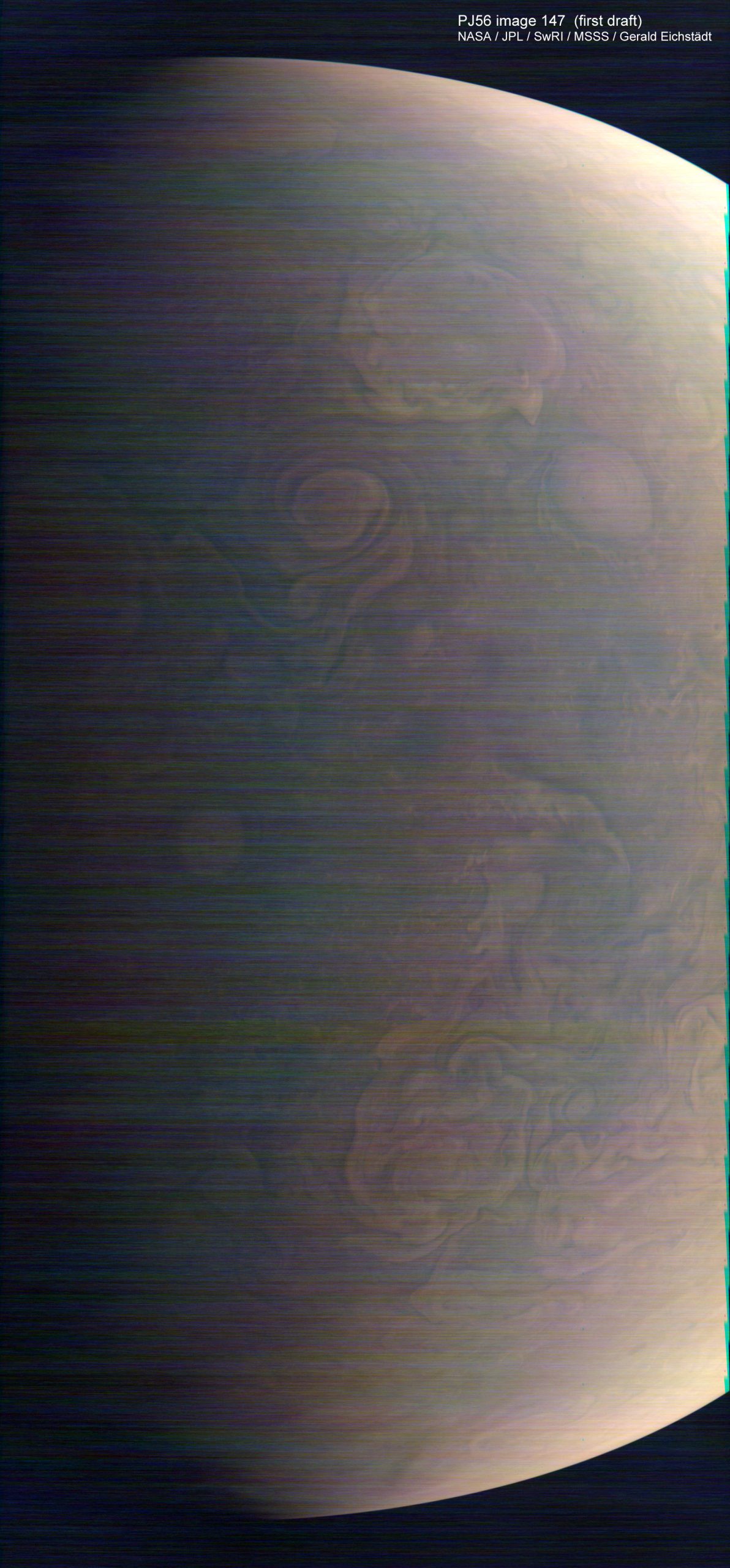
A significant problem developed during this flyby, apparently due to the radiation exposure. From the final approach sequence onwards, all the images are degraded by ubiquitous streaky noise, not seen before. There has been no detailed explanation of the problem, but it may be a permanent electronic fault. The JunoCam team leader posted:
“JunoCam is now showing the effects of that radiation on some of its parts. PJ56 images show a reduction in our dynamic range and an increase in background and noise. We invite citizen scientists to explore new ways to process these images….”
Gerald Eichstädt and Björn Jónsson, among others, are working to restore the images as far as possible.
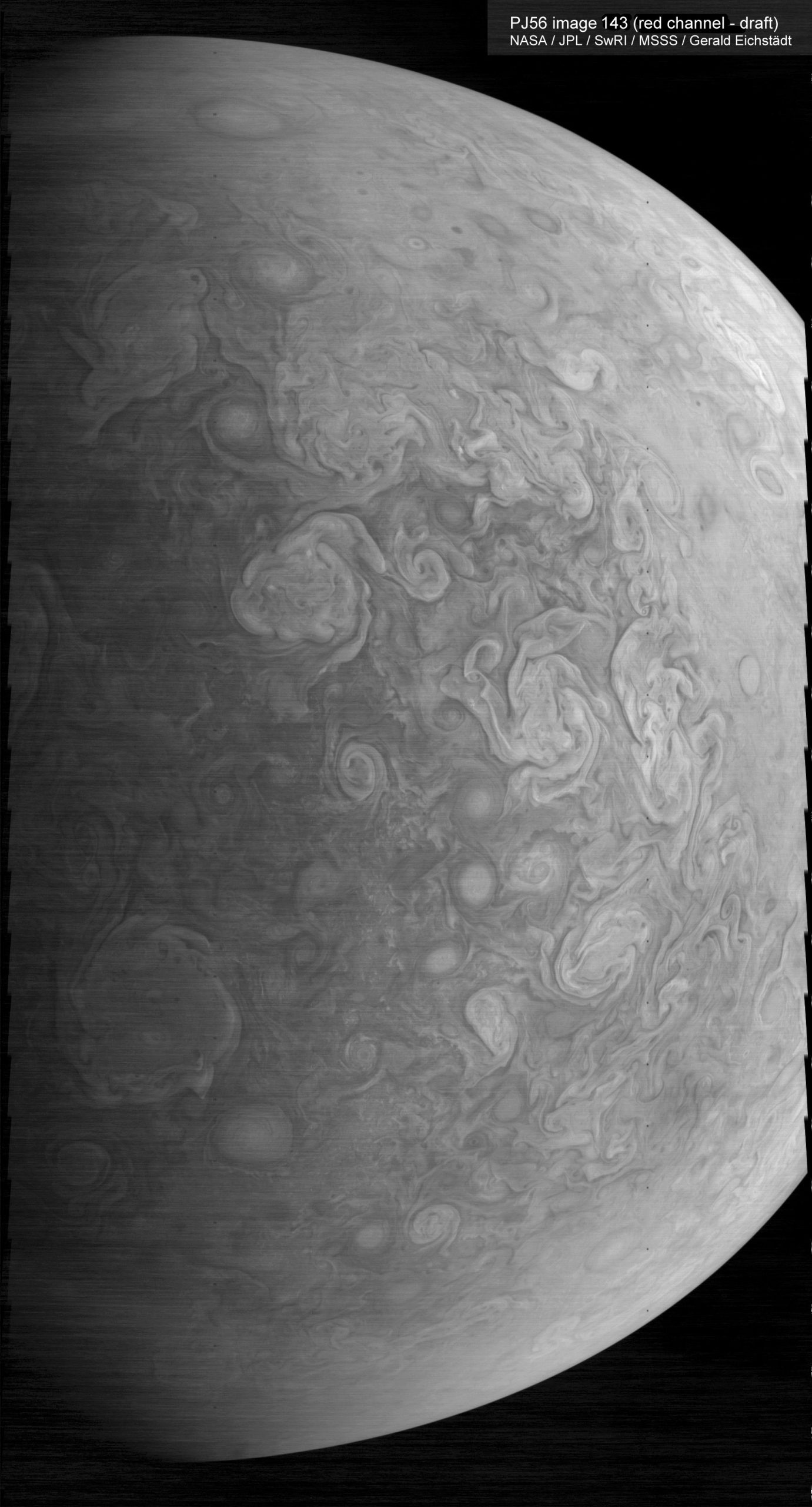
The high background and noise are present in all channels so low-brightness parts of images are worst affected, viz. the green and blue channels and near-terminator regions. The red channel is the best, and adequate for the high northern latitudes in the late inbound images (Figure 2). [In all the figures, I have enhanced the overall contrast.]
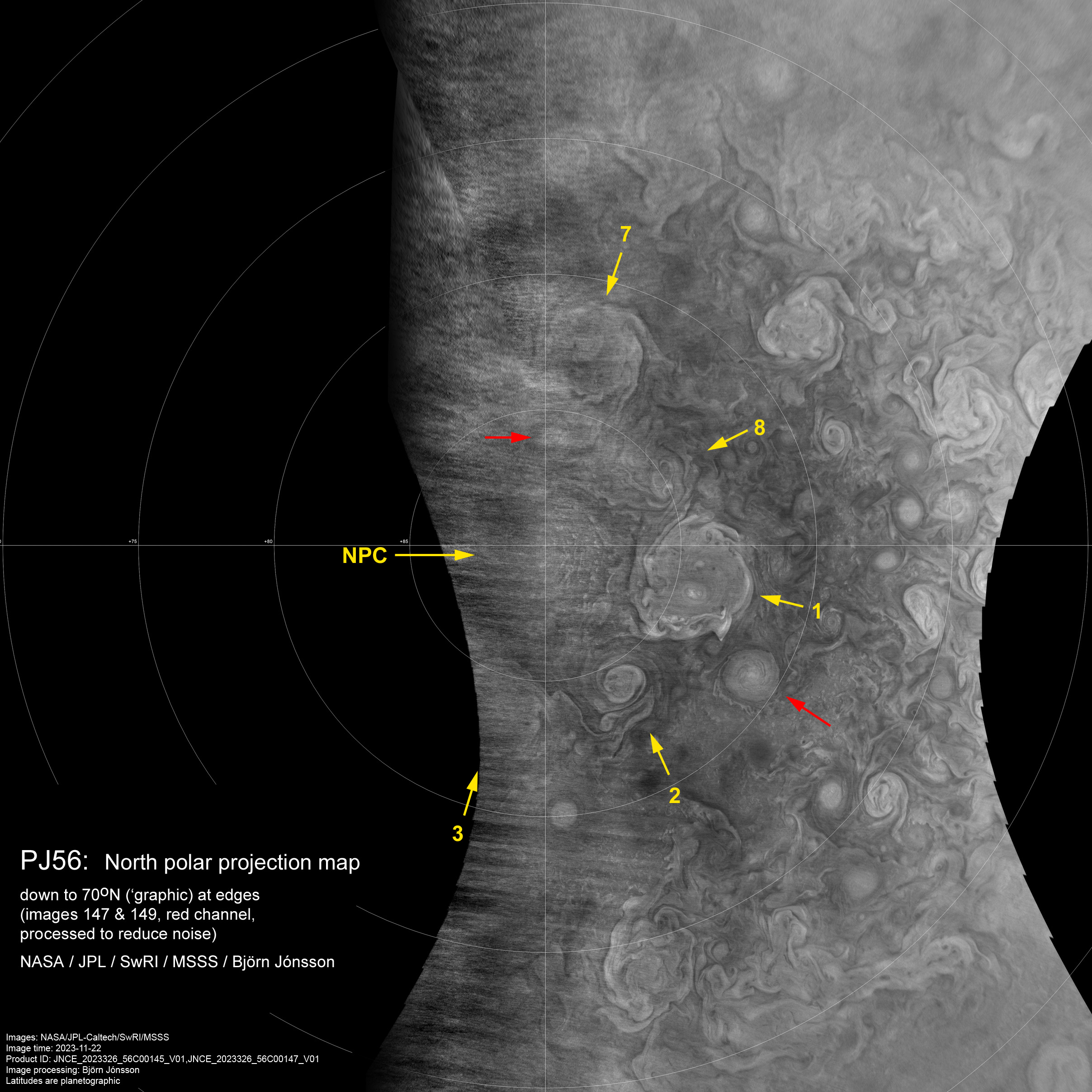
The images of the north pole, important for monitoring the circumpolar cyclones (CPCs), were strongly affected (Figure 3A). Björn has now processed a pair of these images to remove as much of the noise as possible, and created a north polar map from the red channels (Figure 3B). Here we can see five of the 8 CPCs and the central North Polar Cyclone, and some of the associated AWOs that we have been tracking. CPC-1 at first glance seems to have a double core: as shown on the map, its anticyclonic core is displaced ‘below’ the geometric centre and there is a large swirl that may be a cyclonic eddy ‘above’ the centre. This asymmetry has been developing gradually over the last few perijoves.
This account will probably be updated as more progress is made on restoring the images.
________________
[Addendum, 2024 May 28:]
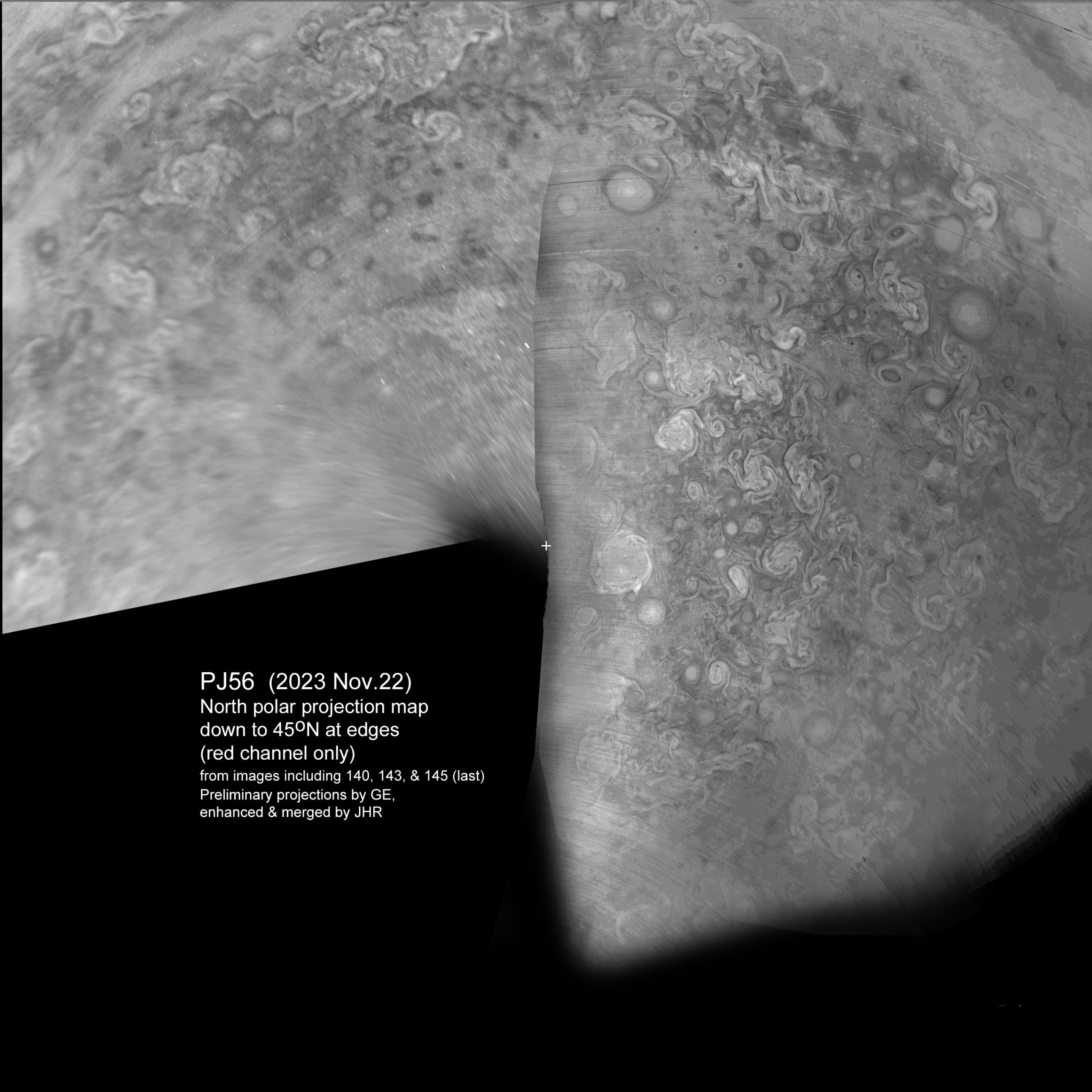
Figure 4 is a composite north pole projection map down to lower latitudes, also using the red channel only, from Gerald’s processing of the uncorrected images. This shows the Bland Zone, FFRs and AWOs, and allows comparison with maps from PJ55 and PJ57 and from hi-res amateur images in November.
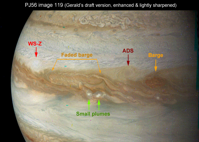
The inbound images included the same interesting sector of the NEB as at PJ55 and PJ57, so Figure 5 can be compared with figures in those perijove reports.
The whole report is available here as a PDF: Prelim-report-on-PJ56_JHR
________________
Figures 1, 2, 3A, 3B:
Figures 4 & 5:
| The British Astronomical Association supports amateur astronomers around the UK and the rest of the world. Find out more about the BAA or join us. |
