JunoCam at PJ61
JunoCam images at PJ61
–John Rogers (BAA)
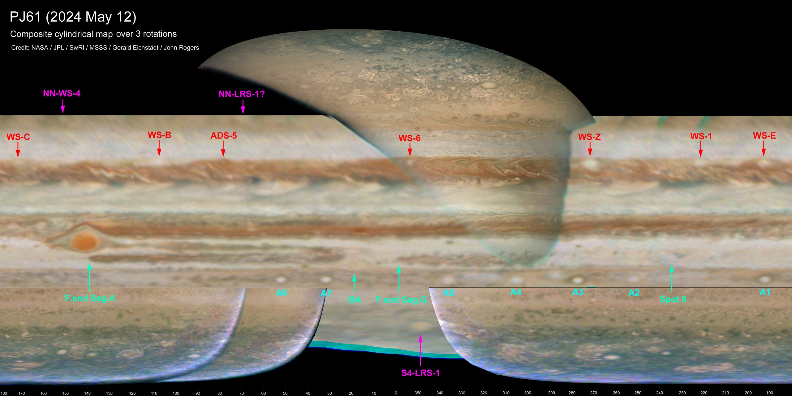
Perijove-61 was on 2024 May 12. Perijove was at 51.3ºN and equator crossing at L3=156, both on the dark side as usual. Jupiter at this time was invisible from Earth (solar conjunction being on May 18), so the inbound images from JunoCam, spanning two rotations, were invaluable in showing the state of the planet at this time. These maps show continuing development of the NEB since PJ60. Sample images are in Figure 1. Our composite global map is in Figure 2, and a hi-res map of the NEB by Kevin Gill is in Figure 3. Imaging is now constrained by the spacecraft orientation as the orbit evolves, so that part of the planet no longer falls within the field of view during the late inbound phase (Figure 1). So the map (Figure 2) is mainly from the first inbound rotation. However, the last inbound images covered part of the northern hemisphere well (hence a sector in Figure 2, and the map in Figure 3) – until overwhelmed by radiation. The intense radiation belt increasingly disrupts the imaging as Juno flies over the north polar region, and after images 137 (RGB) & 138 (CH4), little was received except a small part of image 143 (Figure 4). Unfortunately, all images of the north polar cyclone cluster were lost. Nevertheless, the outbound imaging resumed as normal (Figure 5). Further details are in the image captions in the attached PDF.
The report with mini-figures is in this PDF: Report-on-PJ61
The full-size figures are in this ZIP file: PJ61-Report_Figures
Here is the global map, showing the planet while it was invisible from Earth behind the Sun:
| The British Astronomical Association supports amateur astronomers around the UK and the rest of the world. Find out more about the BAA or join us. |