JunoCam at PJ66
JunoCam images at PJ66
Juno’s Perijove-66 was on 2024 Oct.22. Perijove was at 55.8ºN, L3 = 354, and equator crossing was at L3 = 21, all on the dark side as usual. The track longitude was only 13º from the PJ65 track, so the same features were imaged again on the inbound leg.
The flyby began with a distant pass by Io. Images showed the same view as at PJ64, but the disk size was smaller and no changes nor plumes were readily visible.
Figure 1 is a ground-based map of Jupiter on Oct.19-20 (made by Rob Bullen from images by Isao Miyazaki). Figure 2 (copied below) is our JunoCam map at PJ66. Figure 3 shows anticyclonic ovals in three of the images. (A) NEBn WS-E, about to merge with s smaller one (see BAA 2024/25 Report no.2; (B) The long-lived N5-AWO ; (C) S4-LRS-1, which had probably just merged with a smaller AWO.
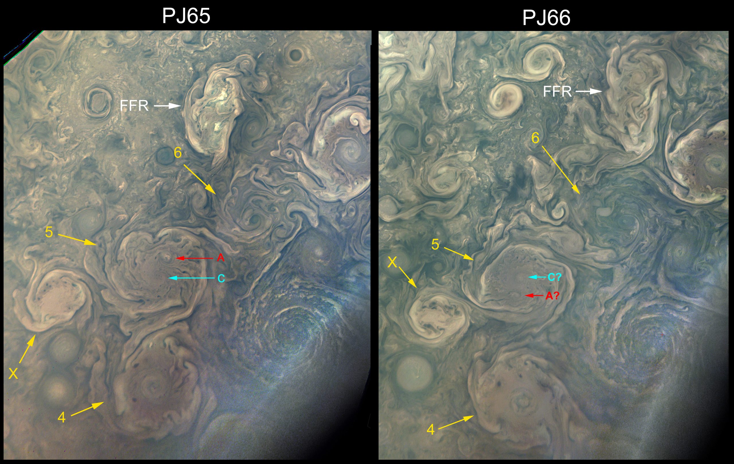
Figure 4 is our north polar projection map. Figure 5 is our map of the north polar cyclone cluster, and Figure 6 (copy below) compares part of it with the PJ65 map. Figure 7 is the south polar projection map from the outbound images. (Maps and images were processed by Gerald Eichstädt.)
The full report, with mini-figures, is in this PDF: Report-on-PJ66
The full-size figures are in this ZIP file: PJ66-Report_Figures


| The British Astronomical Association supports amateur astronomers around the UK and the rest of the world. Find out more about the BAA or join us. |
