Maps of Mars
Maps
All intending observers need a map to refer to. Although certain features have undergone significant and apparently permanent changes since its compilation, Dr Ebisawa’s detailed general map of 1957 is useful for the naming of small features, and the writer’s paper in the Bibliography includes reproductions of both the IAU map and the Ebisawa map. A recent map compiled by the Planetary Section of the Unione Astrofili Italiani (UAI) is reproduced here to show what the observer might currently expect to see at the eyepiece. All these charts, together with a high-resolution map by Damian Peach (from the 2005 opposition), are available on this page.
Submission of Observations
Images, preferably in Jpeg format, should be e-mailed to the Director on a daily basis. The preferred file name format is yyyy-mm-dd-ttttUT-initials: for example, 2008-04-30-2030UT-RJM for an image taken on 2008 April 30 at 2030 UT by the Director. There is no need to preface the file name with ‘Mars’, and any images submitted in another format will in any case be changed to the above style for archiving purposes.
Any further information should be written upon the image rather than added to the file name. These details should include telescope and camera, observing location, the origin of any filters used, and a note of seeing conditions (especially if very good or very poor). Some observers like to add a few brief notes, but these should really be brief.
Drawings may be sent through the post as hard copies in the usual way, or emailed regularly as above. It is useful if the standard report form for drawings is used: a copy may be downloaded from this website.
Maps of Mars
(Click on all images to open full sized versions in a new tab)
Ebisawa : Mottoni : Adachi : Frassati : Aeschliman : Peach : Adelaar : Lewis
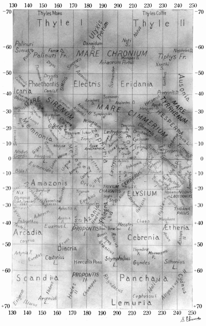
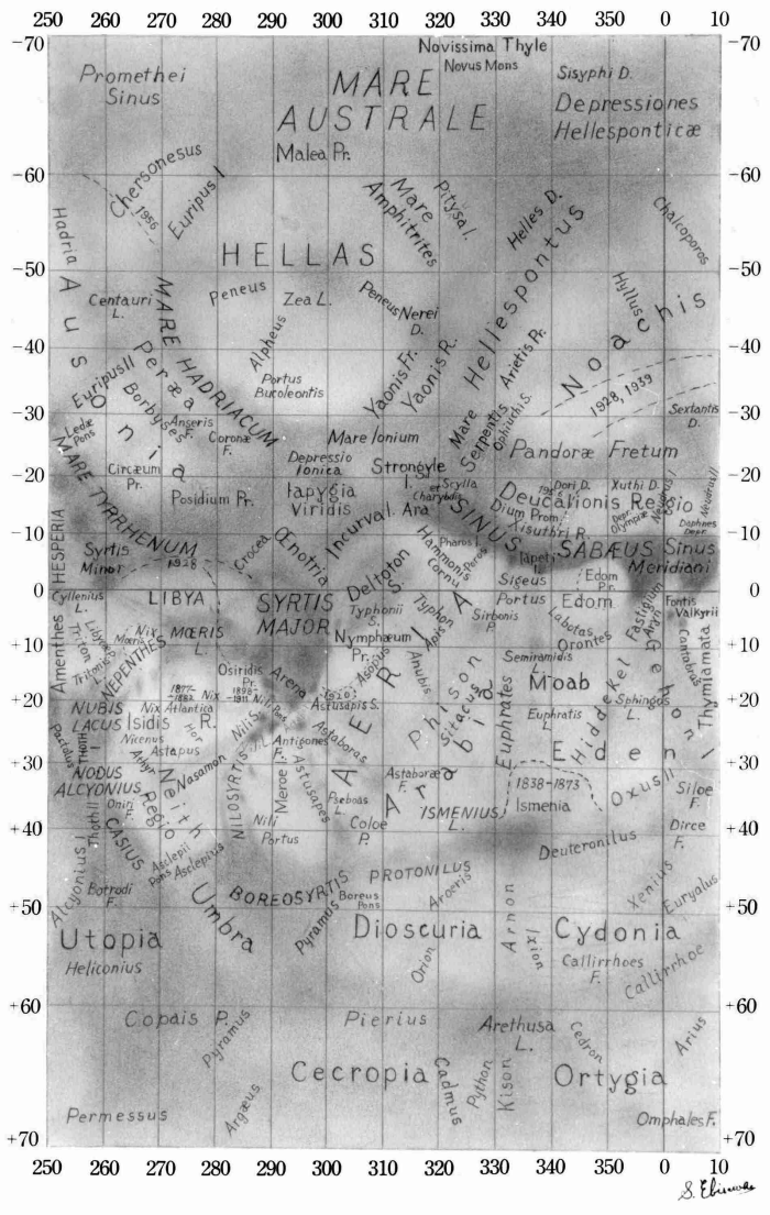
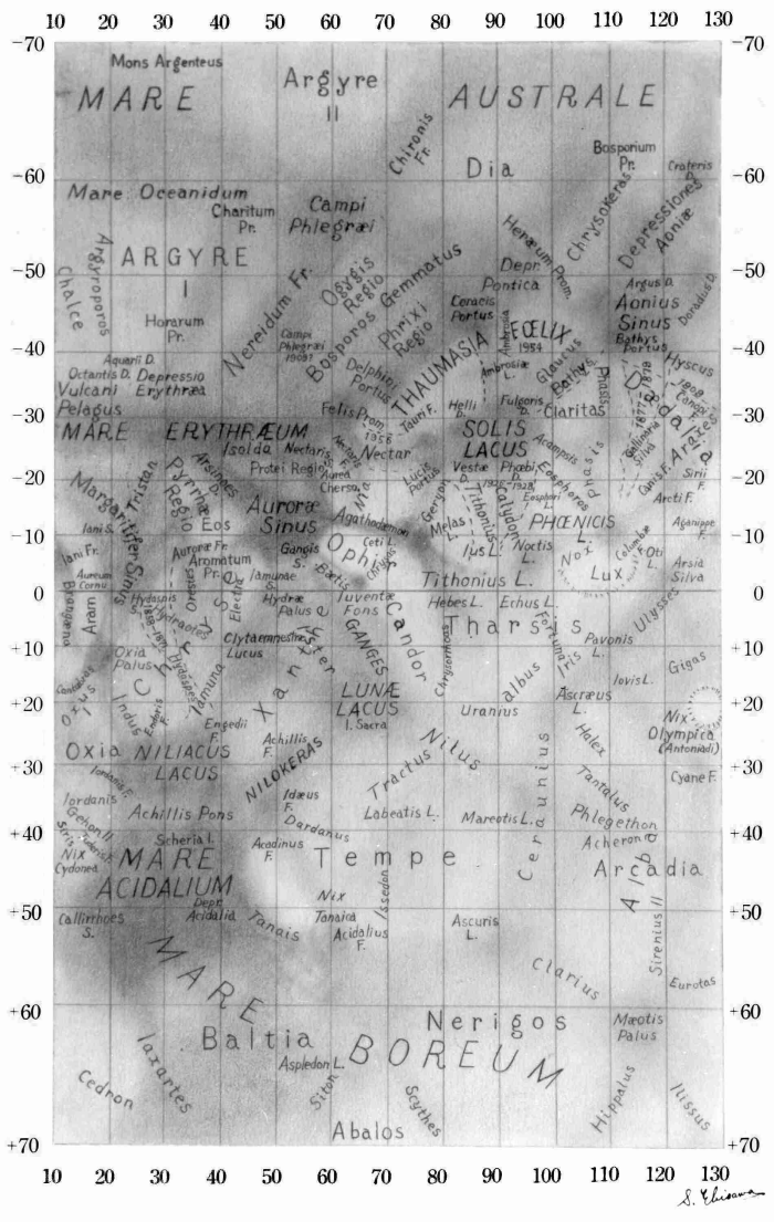
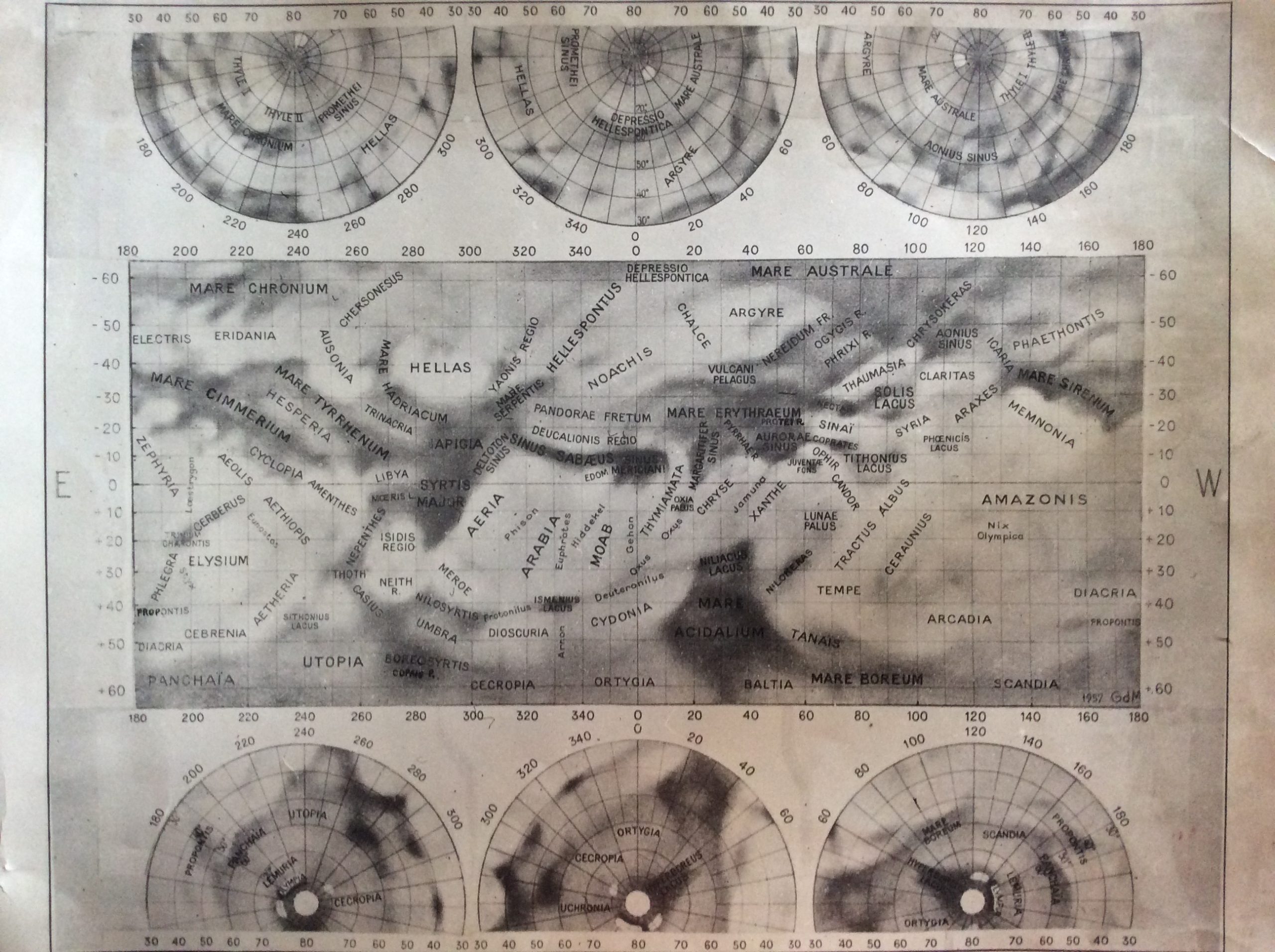
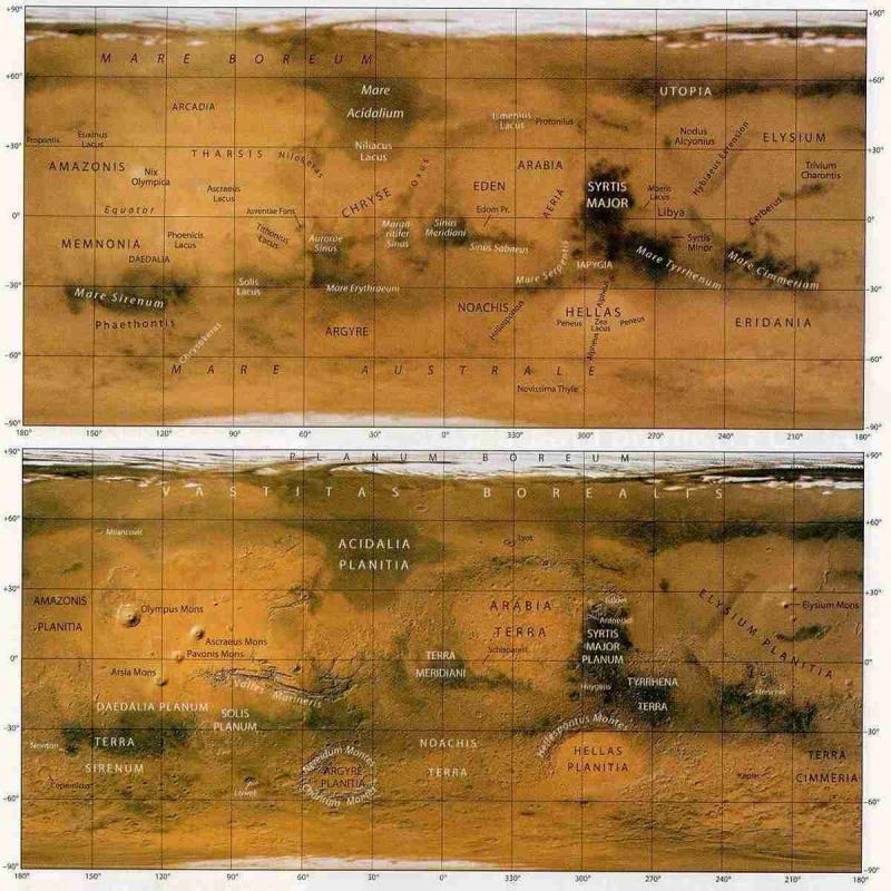
A three-part map by Shiro Ebisawa (1957), with very detailed nomenclature appears below. This map is regarded, by the BAA Mars Section, as the standard reference for names, for the IAU map from the same era (below) contains too few names to be of real use. However, both are average representations of the planet, and Mars will never exactly resemble either map. Since the epoch of the 1950s, major and apparently semi-permanent albedo changes have occurred in the Casius–Boreosyrtis region, and the curved feature at the E. side of the Syrtis Major, Nepenthes, has not been seen since the decade of the 1970s. Mario Frassati’s more recent map (below) gives a better impression of those areas. Click images for large versions (700 x 1105 pixels).
 |
 |
 |
The standard IAU map by G. de Mottoni (1957), based upon the best available photographic work from the 1940s and 1950s. It shows all the detail visible with small apertures, and is good for quick reference. Click on image for large version (1912 x 2260 pixels).
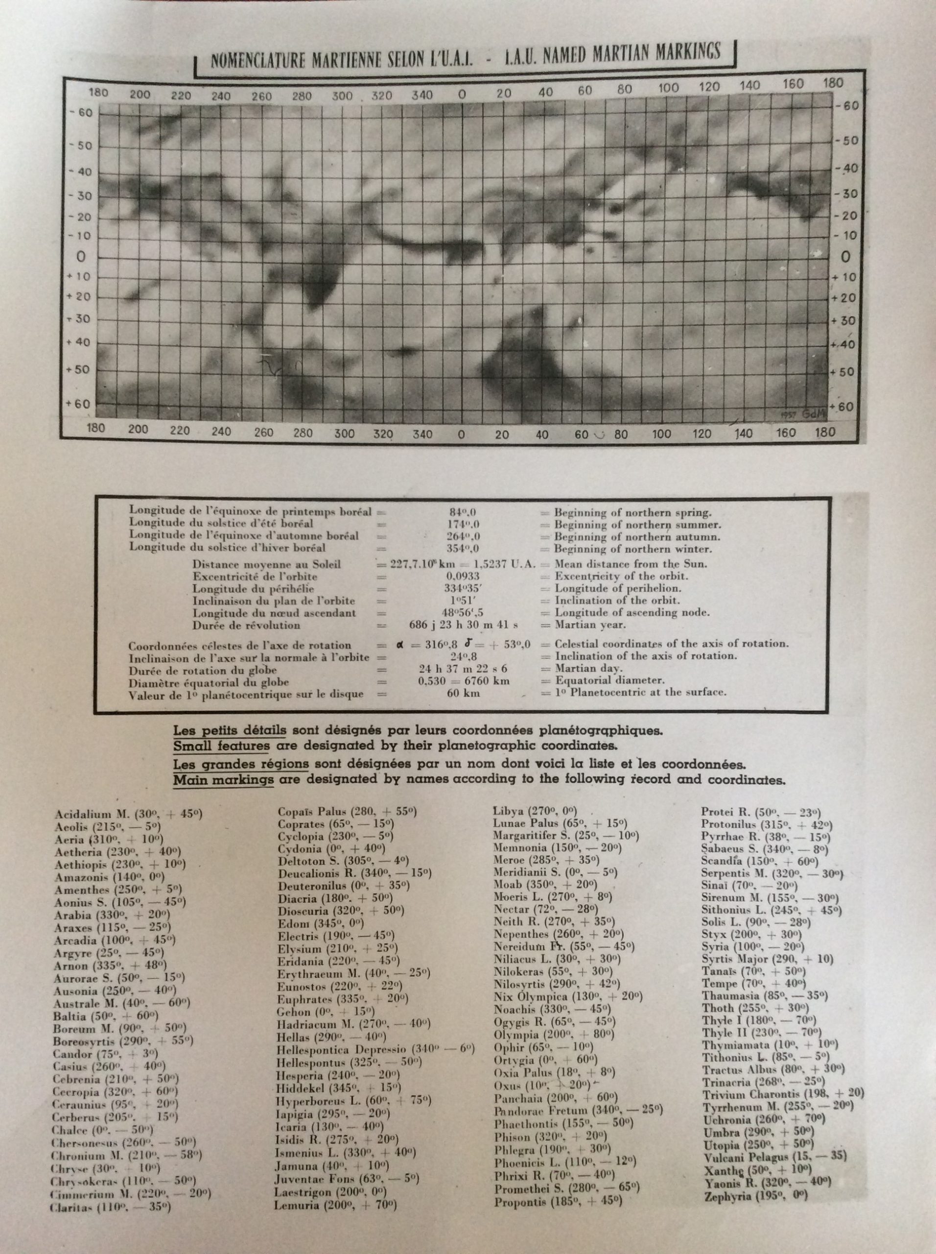
IAU Albedo Map Click on image for large version (1912 x 2260 pixels)
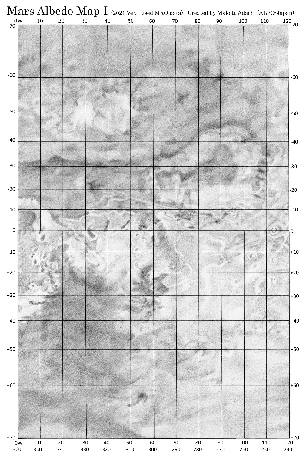
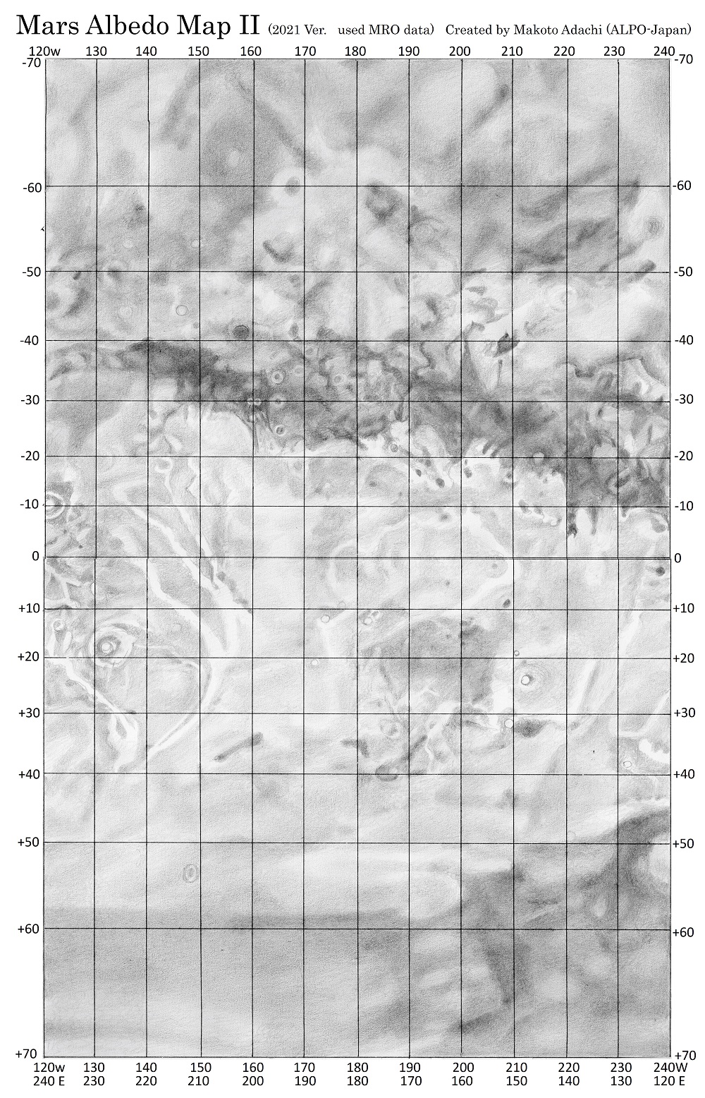
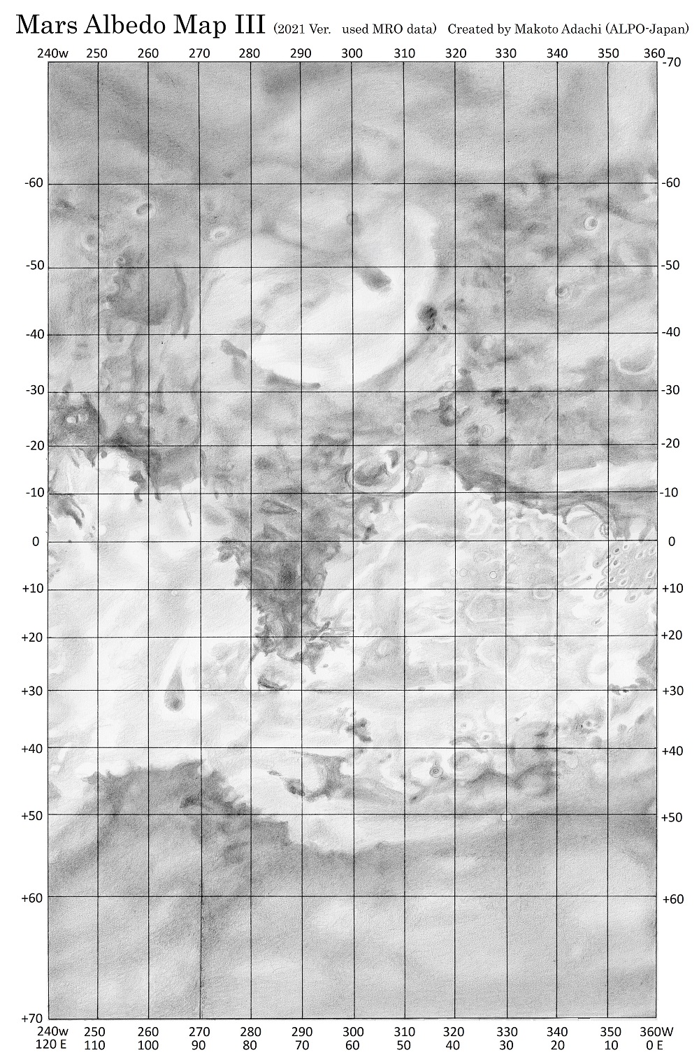
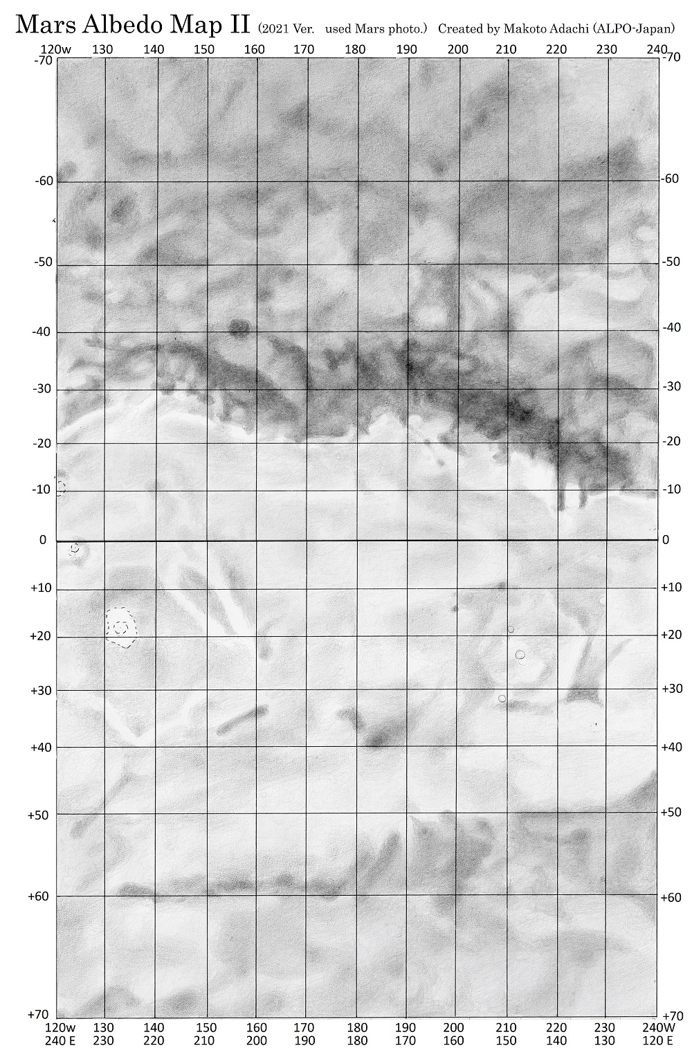
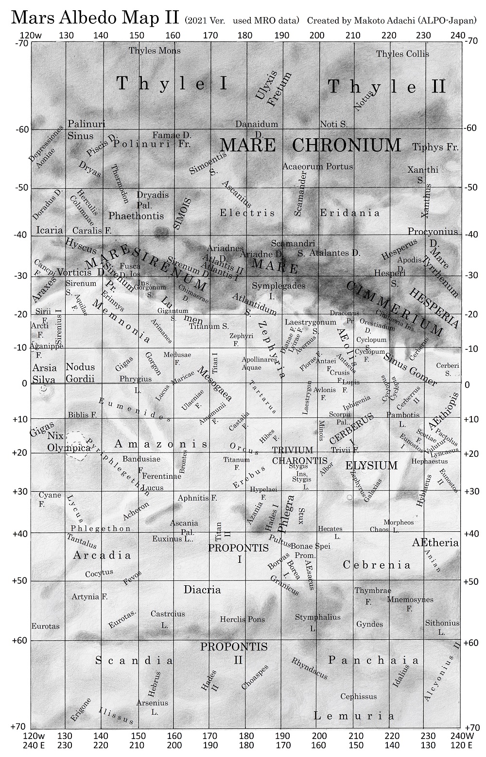
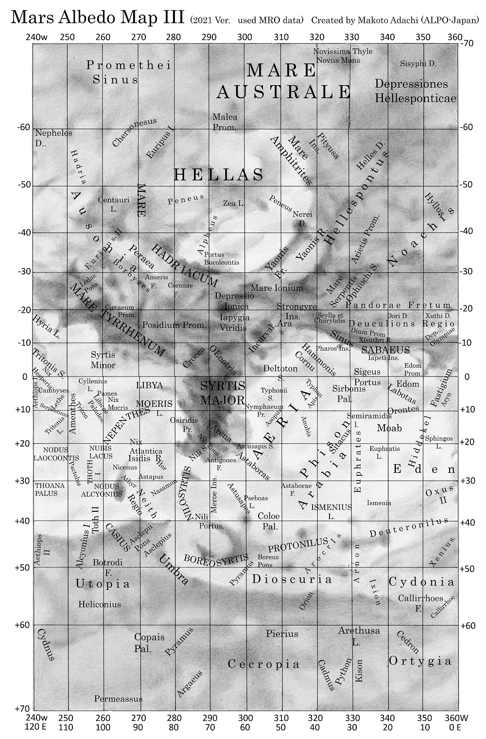
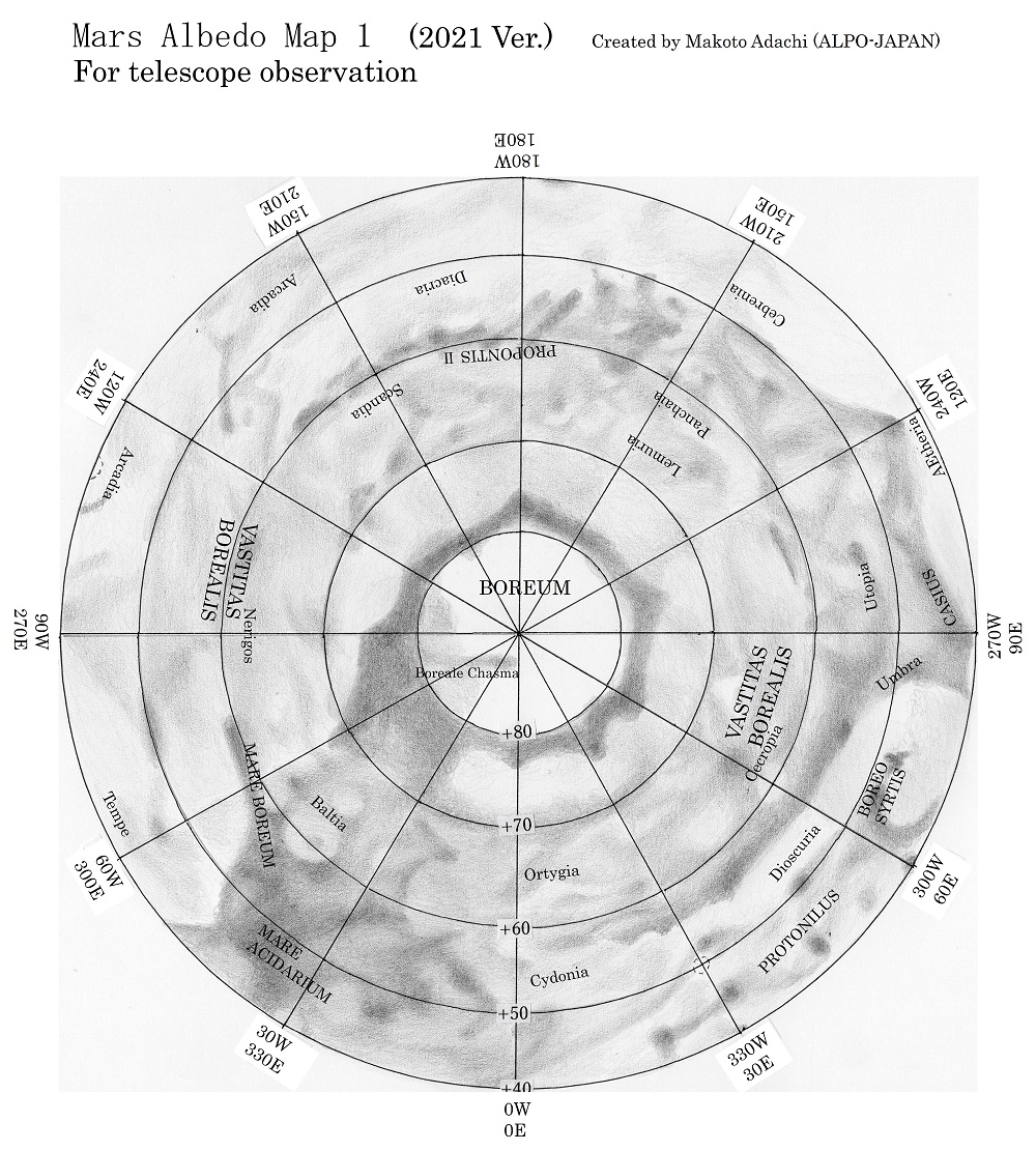
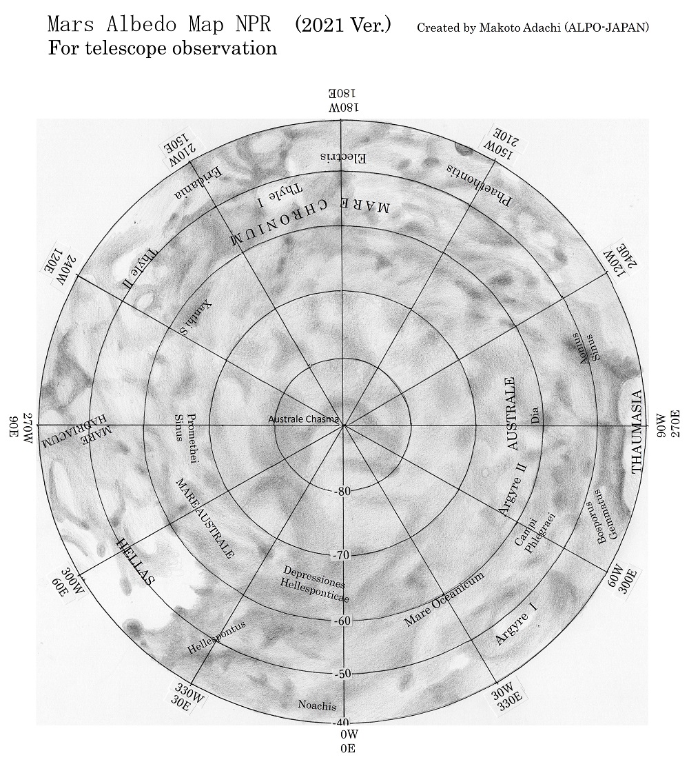
Makoto Adachi’s newly drawn albedo maps (completed Spring 2022) bring the classic Ebisawa map of 1957 up to date, and offer versions with or without the classic nomenclature. We have been given permission by Adachi to upload the maps here. The maps consist of three sectors of the planet either with or without Ebisawa’s telescopic nomenclature. (The Director gave some help with checking of the latter.) These new maps fall under the headings of “MRO public image” maps, which are the best resolution maps (with and without names), or “Mars Maps for visual observation”, which are presented at reduced resolution so as to closely confirm to telescopic observation. North up and south up versions are available. In a significant addition to the Ebisawa map, Adachi also presents N. and S. polar projections.
Click on images for larger versions in a new tab.


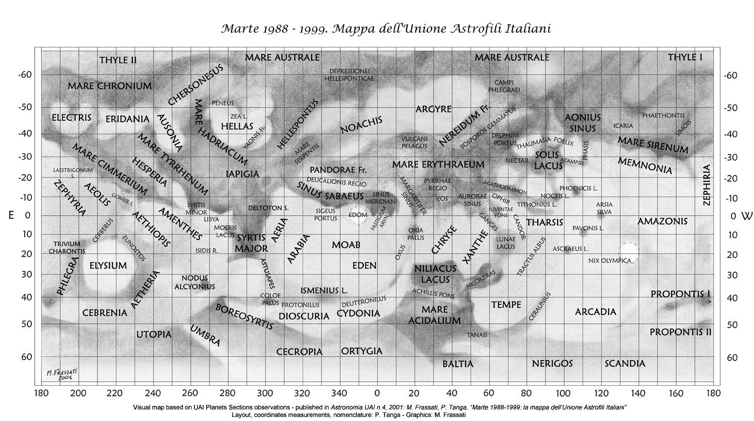
The map drawn by Mario Frassati (2001) for the Unione Astrofili Italiani. It is based upon that organisation’s work during 1988–99, and shows the principal features of Mars at the 1999 opposition. This is a convenient up-to-date reference chart, though the most currently useful maps will always be those that appear in the BAA apparition reports. Click on image for large version (1500 x 837 pixels).
Two maps of Mars (north at top) prepared by Ralph Aeschliman, originally published in Sky & Telescope (2003 June), and reproduced here by kind permission of the artist. (Upper) classic nomenclature; (lower) modern nomenclature. Click on images for large versions (560 x 560 pixels).
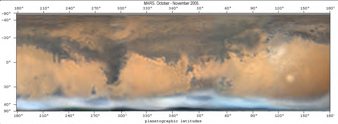
A general map of the planet (south at top) with telescopic nomenclature added, prepared by Damian Peach from his CCD images of 2005 October–November. Most of the albedo features have not changed much since 2005, though Pandorae Fretum has been the most variable feature in the following years, as it waxes and wanes according to dust storm activity. Click on image for the large version (2284 x 840 pixels).

The same image as above, but unlabelled. (Click on image for larger version 1142 x 420)
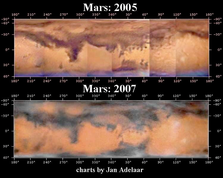
Comparative Mars apparition charts for 2005 and 2007, compiled by Jan Adelaar from his images obtained 2005 October 6–November 9 and 2007 November 15–December 30. These maps appear in the second interim report of the 2007 opposition. (No larger version.)
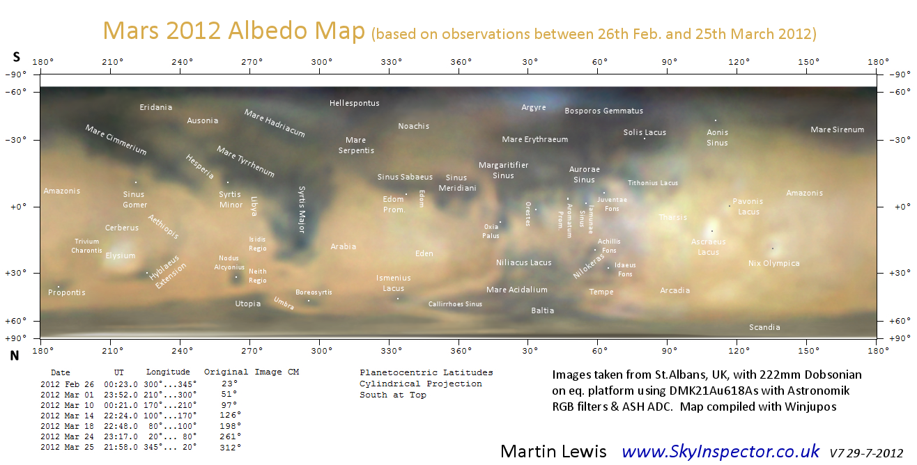
Map by Martin Lewis, 2012. Click on the image for the large version (1300 x 660 pixels).
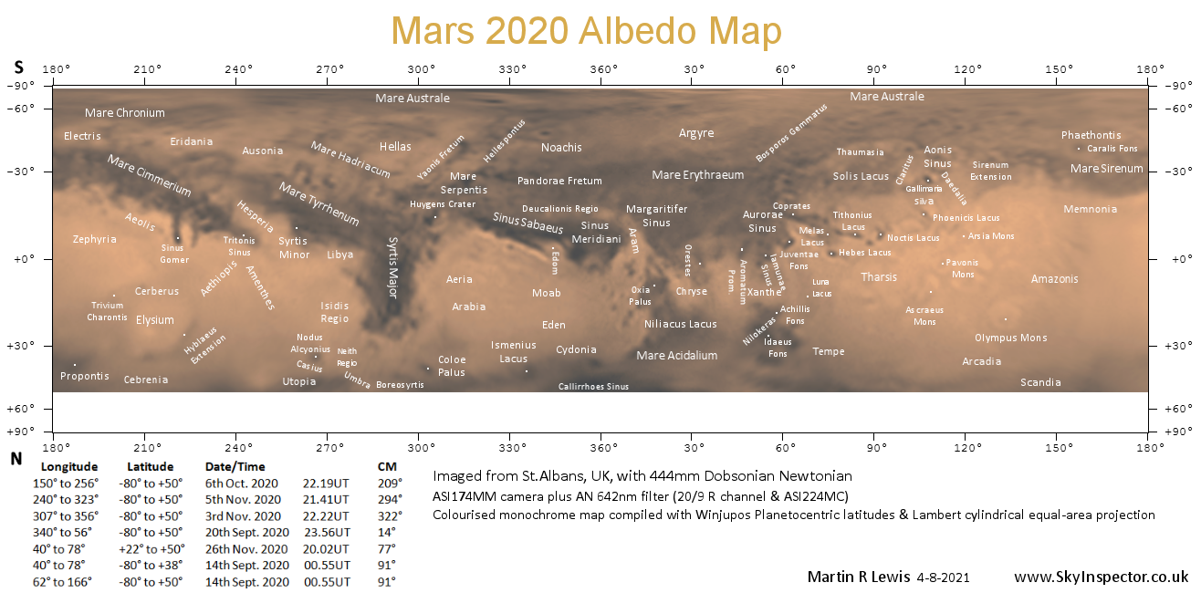
Map by Martin Lewis, 2020. Click on the image for the large version (1316 x 650 pixels)
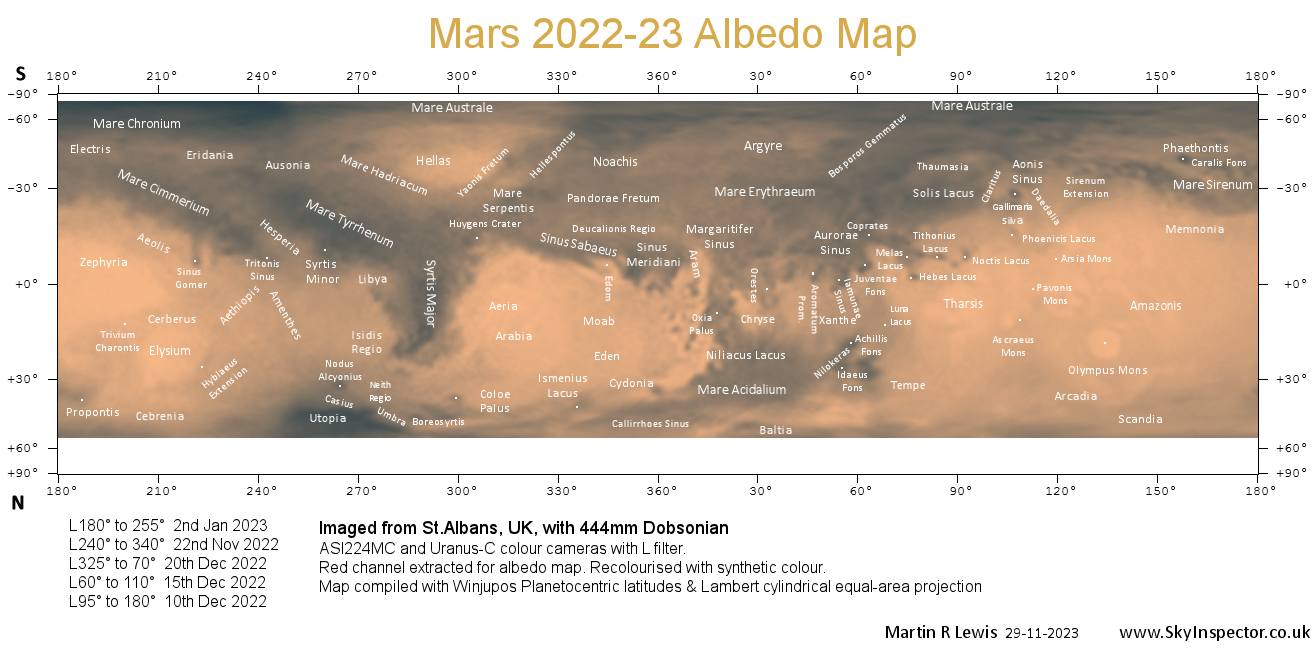
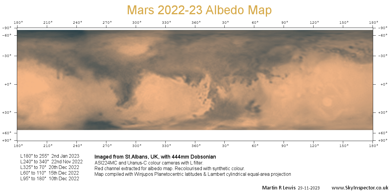
Mars 2022-23 Albedo Map by Martin Lewis, with annotations. Click the image to view a full sized version (1316 x 650 pixels).
Mars 2022-21 Albedo Map by Martin Lewis, without annotations. Click the image to view a full sized version (1316 x 650 pixels).
Return to the Mars Section Programme.
| The British Astronomical Association supports amateur astronomers around the UK and the rest of the world. Find out more about the BAA or join us. |