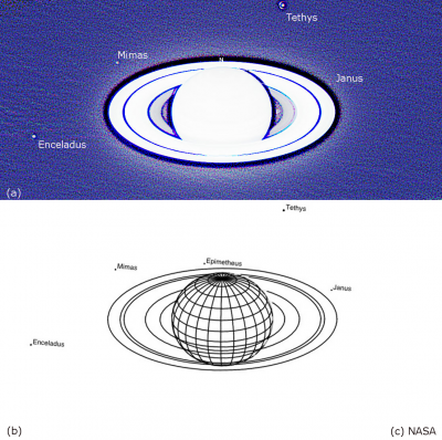
An amateur’s observations of Saturn’s satellite Janus
In these difficult times during the COVID-19 virus pandemic, I am sure that some BAA members have been using the
Read moreSupporting amateur astronomers since 1890
In these difficult times during the COVID-19 virus pandemic, I am sure that some BAA members have been using the
Read more
During the early part of this year we were treated to spectacular, monthly evening conjunctions between the planet Venus and
Read more
Even though there are very few hours of darkness Nick shows that there is much still to see in the Sky
Read more